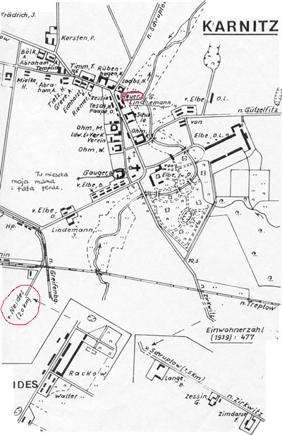
 | This 1939 map was copied from the Chronik des Kreises
Greifenberg in Hinterpommern, which was published in 1990.
I have circled two reference points in red. The first is the location of a home that is a Heuer who still lived there at the time this map was drawn. If you look carfully right in the top center, just to the right of the "Y" in the road you can see the Heuer circled. I have also circled the road leading to Neides. The Karnitz Church is where all the neighboring village people would worship. Karnitz is a very old village established in the early 1300's by theVon Karnitz family. |